Weather Warnings New Zealand: Red Alerts & Safety Guide
New Zealand’s weather can change in the space of a few hours—sometimes faster. One day you’re enjoying a calm afternoon, the next you’re facing a severe thunderstorm warning. Understanding how the country’s multi-tiered weather alert system works isn’t just interesting; it can mean the difference between staying safe and being caught unprepared. MetService, the official meteorological service, issues warnings days in advance to give people time to prepare.
Heavy rain warning threshold: 25mm per hour or more ·
Strong wind warning threshold: 110 km/h (60 knots) or more ·
Severe weather warning levels: Yellow (watch), Orange (take action), Red (emergency) ·
Official weather warning provider: MetService (New Zealand Meteorological Service)
Quick snapshot
- MetService is the official source for weather warnings in New Zealand (MetService – Weather Warnings & Watches)
- Red warnings are issued for specific meteorological thresholds (MetService – About Severe Weather Warnings)
- A tsunami monitoring network exists and is operated by Civil Defence (NEMA – Alerts and warnings)
- Exact timing and path of tropical cyclones (e.g., Cyclone Tam) are uncertain until close to landfall (MetService – About Severe Weather Warnings)
- Whether a specific warning level will escalate to red depends on evolving conditions (NEMA – Red weather warnings are serious business)
- Days before: Severe Weather Outlook (potential risk) (MetService – About Severe Weather Warnings)
- 24-48 hours: Yellow Warning (Watch) (MetService – Severe Weather Outlook)
- 6-24 hours: Orange Warning (Take Action) (MetService – Severe Weather Outlook)
- 3-6 hours or during: Red Warning (Emergency) (NEMA – Red weather warnings are serious business)
- Check MetService’s live warnings page for active alerts (MetService – Weather Warnings & Watches)
- Sign up for emergency alerts from Civil Defence (NEMA – Alerts and warnings)
- Follow GetReady.govt.nz for storm preparation steps (GetReady.govt.nz – Storms)
Here is a summary of the official organizations and warning categories.
| Category | Details |
|---|---|
| Official meteorological service | MetService (MetService – Weather Warnings & Watches) |
| Emergency management agency | National Emergency Management Agency (NEMA) (NEMA – Alerts and warnings) |
| Tsunami monitoring authority | Civil Defence (NEMA – Alerts and warnings) |
| Warning types covered | Heavy rain, strong wind, heavy snow, thunderstorms, tsunami (MetService – Weather Warnings & Watches) |
What is the weather condition in New Zealand now?
Current weather overview
- MetService issues real-time weather warnings for all regions (MetService – Weather Warnings & Watches)
- Heavy rain and thunderstorm warnings may be in effect depending on the season (MetService – Severe Weather Outlook)
- Current conditions vary by region; check official sources for the latest updates (MetService – Weather Warnings & Watches)
For real-time conditions, the MetService warnings page (official weather hub) shows all active watches and warnings across the country. The page updates as new data arrives from weather stations and satellite imagery.
A “current” weather overview changes fast. Heavy rain bands can develop in under an hour, so checking once in the morning may not be enough if you’re heading outdoors.
Active warnings and watches
- MetService distinguishes Severe Thunderstorm Watches and Warnings from general severe weather warnings (MetService – Thunderstorm Outlook)
- Road Snowfall Warnings are a separate product for alpine passes (MetService – Weather Warnings & Watches)
- Yellow (watch) means potential severe weather; be aware and plan ahead (MetService – About Severe Weather Warnings)
The implication: Not every alert is the same. A thunderstorm watch needs a different response than a road snowfall warning.
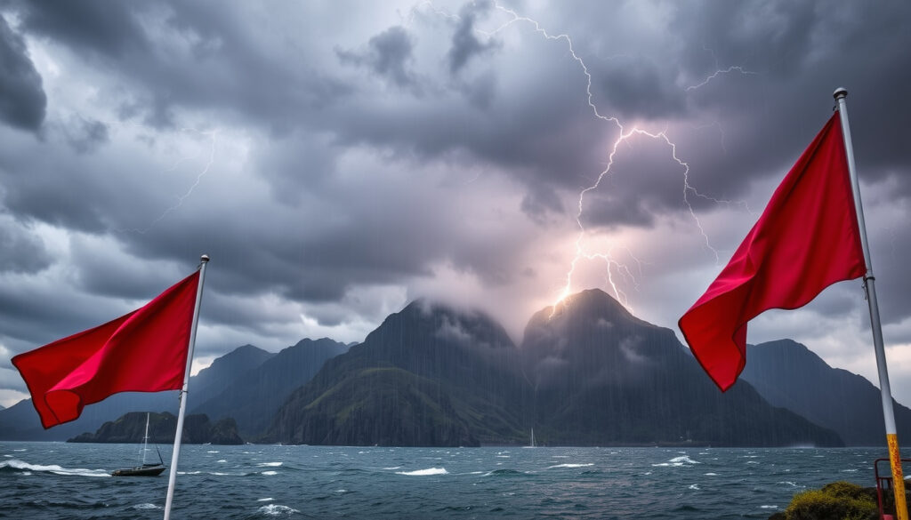
What is the red weather warning in New Zealand?
Definition of Red warning
Red warnings are the highest alert level. According to NEMA (National Emergency Management Agency), “red weather warnings are serious business.” They mean severe weather is imminent or already occurring, and immediate action is needed to protect life and property.
When a Red warning is issued
MetService issues a Red warning when conditions meet or exceed specific thresholds:
- Heavy rain: 25mm per hour or more (MetConnect – Warnings (MetService help))
- Large hail: 20mm diameter or more (MetConnect – Warnings (MetService help))
- Strong wind gusts: 110 km/h (60 knots) or more (MetConnect – Warnings (MetService help))
These thresholds are defined in the MetConnect help documentation and are used by both MetService and emergency responders.
When you see a Red warning, don’t wait for a second alert. NEMA advises people near rising waters to get to higher ground immediately. The warning is the trigger, not a suggestion.
How to respond to a Red warning
- Follow instructions from Civil Defence and emergency services (NEMA – Red weather warnings are serious business)
- Avoid travel in affected areas – the U.S. Mission New Zealand advises staying off roads (U.S. Mission New Zealand – Severe weather guidance)
- Do not enter floodwaters – even shallow moving water can sweep vehicles away (U.S. Mission New Zealand – Severe weather guidance)
The trade-off: A Red warning saves lives, but it also disrupts travel and business. The cost of ignoring it far outweighs the inconvenience.
Is Cyclone Tam hitting NZ?
Current tropical cyclone activity near New Zealand
According to MetService (official meteorological service), tropical cyclone outlooks are issued several days in advance. Cyclone Tam has brought widespread flooding to parts of New Zealand, with heavy rain and damaging winds affecting several regions.
Impacts of Cyclone Tam: flooding and wind
GetReady.govt.nz advises staying up to date with MetService weather information during cyclone events (GetReady.govt.nz – Storms). Heavy rain from Cyclone Tam has caused river flooding and landslips in vulnerable areas.
Official cyclone tracking sources
- MetService provides tropical cyclone outlooks and warnings (MetService – Severe Weather Outlook)
- For the latest advisories, check the MetService warnings page (MetService – Weather Warnings & Watches)
The pattern: Cyclone tracks are uncertain until 24-48 hours before landfall. Even then, small shifts in the storm’s path can change which regions get the worst impacts.
Is New Zealand in danger of a tsunami?
Tsunami risk in New Zealand
New Zealand is at risk from both local and distant-source tsunamis, particularly along the east coast of the North Island and the south of the South Island. NEMA (National Emergency Management Agency) states that there will not always be time for an official warning, so people should recognize natural warning signs and act quickly.
Tsunami warning system and monitoring network
Civil Defence operates a tsunami monitoring and detection network that includes sea-level gauges and seismic sensors. Warning levels are:
- National Warning – Threat: A tsunami is imminent or occurring
- Advisory: A tsunami may follow – stay informed
- Information: No threat – but be aware
Natural warnings – a long or strong earthquake, or a sudden rise or fall in sea level – are your fastest cue. Don’t wait for an official alert if you feel the ground shake for more than a minute.
What to do during a tsunami warning
- Get to higher ground immediately if near the coast (NEMA – Red weather warnings are serious business)
- Follow evacuation routes designated by local Civil Defence (NEMA – Alerts and warnings)
- Stay away from beaches and waterways until the all-clear is given
Why this matters: New Zealand’s tsunami risk is real. The 2021 tsunami following a Kermadec earthquake showed that even distant sources can produce dangerous waves on our shores.
What do the different weather warning levels mean?
Yellow Warning (Watch)
- Potential for severe weather – be aware (MetService – About Severe Weather Warnings)
- Stay informed via MetService and local news (GetReady.govt.nz – Storms)
- Review emergency supplies and plans
Orange Warning (Take Action)
- Severe weather is likely or imminent (GetReady.govt.nz – Storms)
- Prepare your property and family (NEMA – Red weather warnings are serious business)
- Avoid unnecessary travel in affected areas (U.S. Mission New Zealand – Severe weather guidance)
Red Warning (Emergency)
- Extreme weather is occurring or imminent (NEMA – Red weather warnings are serious business)
- Immediate danger to life and property (MetService – Weather Warnings & Watches)
- Follow instructions from Civil Defence and emergency services (NEMA – Alerts and warnings)
How to interpret each level
These definitions are set by MetService and used by emergency services. The colour system – similar to traffic lights – gives a clear escalation: Yellow = watch, Orange = prepare, Red = act. MetService (official meteorological authority) explains that severe weather warnings indicate areas where rain, snow, or wind may reach warning criteria.
The trade-off: The system prioritises safety, but it relies on people knowing the difference between yellow and red. Without that understanding, the warnings lose their power.
Timeline of a typical severe weather event
The progression from outlook to red warning follows a typical timeline.
| Timeframe | Warning type | What happens |
|---|---|---|
| Days before | Severe Weather Outlook | MetService issues a potential risk notice (MetService – About Severe Weather Warnings) |
| 24-48 hours before | Yellow Warning (Watch) | Be aware, start monitoring (MetService – About Severe Weather Warnings) |
| 6-24 hours before | Orange Warning (Take Action) | Prepare property, avoid travel (GetReady.govt.nz – Storms) |
| 3-6 hours before or during | Red Warning (Emergency) | Immediate action required – follow emergency instructions (NEMA – Red weather warnings are serious business) |
The implication: Each stage gives a specific window for preparation, from days out to minutes before impact.
What’s confirmed, what’s uncertain
Confirmed facts
- MetService is the official source for weather warnings in New Zealand (MetService – Weather Warnings & Watches)
- Red warnings are issued for specific meteorological thresholds (MetConnect – Warnings (MetService help))
- Tsunami monitoring network exists and is operated by Civil Defence (NEMA – Alerts and warnings)
What’s unclear
- Exact timing and path of tropical cyclones (e.g., Cyclone Tam) are uncertain until close to landfall (MetService – About Severe Weather Warnings)
- Whether a specific warning level will escalate to red depends on evolving conditions (NEMA – Red weather warnings are serious business)
What this means: While some factors are fixed, the dynamic nature of weather means you must stay alert as conditions evolve.
Expert perspectives
Heavy rain from thunderstorms of 25mm/h or more; large hail of 20mm diameter or more; strong wind gusts from thunderstorms of 110km/h (60 knots) or more.
MetService official criteria – MetConnect Warnings (MetService technical documentation)
Orange warnings – take action. Orange warnings are used when bad weather will meet Severe Weather Criteria.
GetReady.govt.nz – Official New Zealand emergency preparedness site
For New Zealand residents and visitors, the message is clear: when a Red warning lights up, treat it as a call to action. Check the MetService live warnings page before heading out, especially during storm seasons. If you’re travelling across alpine passes, also check Surf Forecast New Plymouth for coastal conditions and Road Accidents Today Christchurch for safety updates. The decision to stay home or postpone a trip could save your life.
metservice.com, facebook.com, worksafe.govt.nz, facebook.com
For a complete understanding of the warning system and how to respond, read our article on weather warnings and cyclone alerts.
Frequently asked questions
How do I sign up for weather alerts in New Zealand?
You can sign up for Civil Defence emergency alerts via the NEMA alerts and warnings page. MetService also provides push notifications through its mobile app.
What is the difference between a watch and a warning?
A watch (Yellow) means conditions are possible – stay alert. A warning (Orange or Red) means conditions are likely or occurring – take action.
Are weather warnings issued for snow and ice?
Yes. MetService issues Road Snowfall Warnings and heavy snow warnings for alpine passes and high country areas. These are separate from rain and wind warnings.
Can I get warnings for my specific city or region?
Yes. The MetService warnings page shows warnings by region. You can also use the MetService app to set location-based alerts.
How accurate are MetService weather warnings?
MetService warnings are based on high-resolution models and real-time data. Accuracy is high for lead times of 24-48 hours, but decreases for longer outlooks. The service is constantly verified against observations.
What was the most severe weather warning event in New Zealand history?
Cyclone Bola in 1988 and the 2023 North Island floods triggered Red warnings in multiple regions. The 2011 Christchurch earthquake also led to tsunami warnings.
Do weather warnings cover marine and coastal areas?
Yes. MetService issues marine warnings for coastal waters and harbours. These are separate from land-based warnings and are critical for boat owners and fishers.
The bottom line: Knowing the warning system is the first step to staying safe.
More related posts
 Smith and Smith Christchurch – No Law Firm, Auto Glass Facts
 Water Play Tables NZ – Best 2025 Picks for Toddlers
 How Many Weeks Till Christmas 2025 – Countdown Explained
 Mag and Turbo Tauranga: Services, Prices, WOF, and Reviews
 Difference Between RAM and ROM: Key Facts Explained
 Jetstar Christchurch to Auckland: Flights, Timetable & Prices
 My Life Is Murder – Complete Guide to Cast Seasons Streaming
 Toyota Hilux World Record: Largest Gathering, Mileage, and More