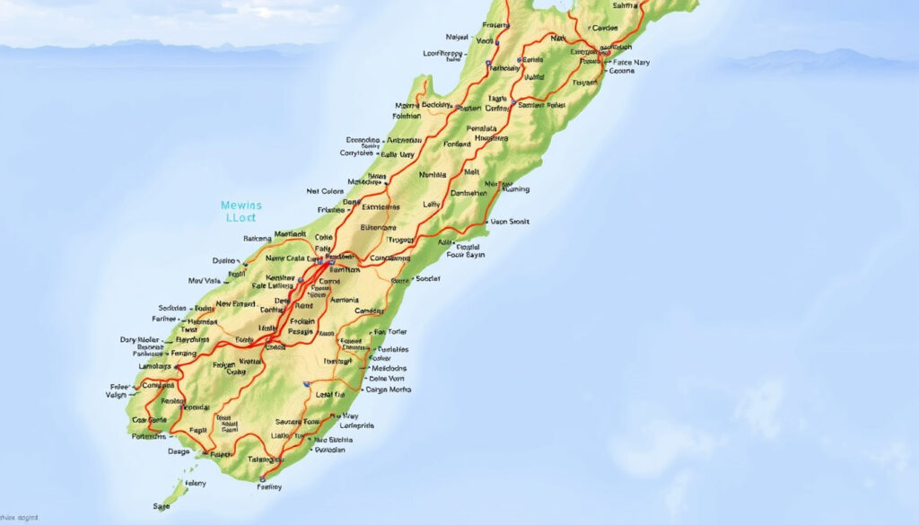
NZ North Island Map: Towns, Drives, Scenic Routes
There’s a moment in every New Zealand road trip where the map stops being a piece of paper and becomes the trip itself. For anyone planning a North Island journey, the challenge isn’t finding a route — it’s choosing which one, for how long, and where the ferry fits in, and this guide treats the NZ North Island map as your planning surface, connecting scenic must-stops, town-to-town driving times, and the Cook Strait car ferry into one clear logic.
Two main islands: North Island and South Island ·
Largest city: Auckland ·
Capital city: Wellington ·
Cook Strait ferry: Wellington–Picton ·
Primary highway: State Highway 1
Quick snapshot
- North Island is one of New Zealand’s two main islands (Tourism New Zealand touring map PDF)
- Auckland is the largest city on the North Island (OutThere.Kiwi visitor guide)
- Wellington is the capital and southern gateway for the Cook Strait ferry (Interislander Ferry timetable)
- Tongariro National Park is a UNESCO World Heritage site (UNESCO World Heritage List)
- Which single scenic spot is “most scenic” is subjective and depends on traveler preference.
- Exact drive time around the North Island varies with route choices, stops, and ferry schedules.
- The Cook Strait ferry crossing takes about 3.5 hours (Interislander Ferry timetable)
- A direct Auckland-to-Wellington drive on State Highway 1 takes roughly 8 hours (New Zealand official travel time calculator)
- Link North Island and South Island routes via the Cook Strait vehicle ferry (Interislander Ferry timetable)
- Use the official tourism map PDF as a printable planning tool (Tourism New Zealand North Island touring map PDF)
Here is a quick reference table of key facts about the North Island.
| Attribute | Value |
|---|---|
| Island role | One of New Zealand’s two main islands |
| Largest city | Auckland |
| Capital city | Wellington |
| Inter-island ferry | Wellington to Picton, about 3.5 hours (Interislander Ferry timetable) |
| Primary highway | State Highway 1 |
| UNESCO site | Tongariro National Park (UNESCO World Heritage List) |
What is the most scenic part of the North Island New Zealand?
Bay of Islands and Northland coast
The Bay of Islands is a coastal region with beaches and marine parks.
- The Bay of Islands is a coastal region with beaches and marine parks (New Zealand official tourism site — Bay of Islands)
- Auckland to Paihia in the Bay of Islands takes about 3 hours by car (Northland NZ map with drive times PDF)
What this means: The Bay of Islands offers a warm start to a North Island itinerary, with beaches, marine parks, and the historic Waitangi Treaty Grounds within a short drive from Auckland.
Coromandel Peninsula
- The Coromandel Peninsula is known for beaches, native forest, and coastal driving routes (New Zealand official tourism site — Coromandel)
- Tourism New Zealand’s North Island touring map labels Whitianga as a key destination on the Coromandel Peninsula (Tourism New Zealand North Island touring map PDF)
What this means: The Coromandel’s winding coastal roads reward drivers who take their time, with Cathedral Cove and Hot Water Beach as signature stops.
Rotorua and the geothermal belt
Rotorua is known for geothermal activity and Maori culture.
- Rotorua is known for geothermal activity and Maori culture (New Zealand official tourism site — Rotorua)
- Rotorua and Taupo are in the North Island’s geothermal zone (New Zealand official tourism site — Geothermal region)
The implication: Rotorua is the kind of place where the land itself tells a story — steam rising from parks, boiling mud pools, and cultural performances that connect visitors to Maori traditions.
Tongariro National Park
- Tongariro National Park is a UNESCO World Heritage site (UNESCO World Heritage List)
- Tourism New Zealand’s North Island touring map labels Taupo as a gateway to Tongariro National Park (Tourism New Zealand North Island touring map PDF)
The pattern: Tongariro is the North Island’s dramatic payoff — alpine volcanic scenery, the famous Tongariro Alpine Crossing, and a dual UNESCO listing for both natural and cultural significance.
A traveler choosing the “most scenic” part of the North Island faces a real trade-off: the Bay of Islands offers coastal warmth, Rotorua delivers geothermal spectacle, and Tongariro gives alpine drama. The best choice depends on the season and the type of scenery that pulls you in.
How long does it take to drive around NZ North Island?
Driving distance vs. driving time
- A direct Auckland-to-Wellington drive on State Highway 1 takes roughly 8 hours (New Zealand official travel time calculator)
- Actual drive time depends on speed limits, road conditions, and how many stops you make (New Zealand official travel time calculator)
The catch: Pure distance on the North Island can be misleading. State Highway 1 is 1,076 km long on the North Island, but between road works, scenic pull-offs, and towns you won’t want to skip, a non-stop drive is neither realistic nor desirable.
Key route segments on State Highway 1
- Auckland to Whangārei: 2 hours (Northland NZ map with drive times PDF)
- Auckland to Paihia: 3 hours (Northland NZ map with drive times PDF)
- Auckland to Kaitāia: 4 hours 30 minutes (Northland NZ map with drive times PDF)
- Auckland to Hokianga: 3 hours 45 minutes (Northland NZ map with drive times PDF)
The trade-off: The Northland route up to Cape Reinga eats time — about 4.5 hours from Auckland to Kaitāia. It’s worth it if you want the far north’s beaches and the lighthouse at Cape Reinga, but it adds a full day to any itinerary.
Planning stops and overnight breaks
- Search and itinerary planning commonly use a 10-day window for a full North Island route (New Zealand official tourism site — North Island itineraries)
- Northland’s official drive-time map includes ferry routes like the Hokianga vehicle ferry with an approximate 15-minute crossing (Northland NZ map with drive times PDF)
Why this matters: Overnight stops are the secret to making the North Island manageable. Plan for a night in the Bay of Islands, one in Rotorua or Taupo, and one in Wellington — that gives you three solid driving days with time to breathe.
What towns are on the North Island of New Zealand?
Major cities
- Auckland is the biggest city on the North Island (OutThere.Kiwi visitor guide)
- Wellington is the capital and the southern gateway for the Cook Strait ferry (Interislander Ferry timetable)
- Other well-known North Island towns include Hamilton, Tauranga, Rotorua, Taupo, Napier, Hastings, New Plymouth, and Whangarei (Tourism New Zealand North Island touring map PDF)
Coastal towns
- The Bay of Islands region includes Paihia and Kerikeri (New Zealand official tourism site — Bay of Islands)
- The Coromandel Peninsula includes Whitianga and Thames (Tourism New Zealand North Island touring map PDF)
- East coast towns include Gisborne and Napier (Tourism New Zealand North Island touring map PDF)
Lake and geothermal towns
- Taupo sits on Lake Taupo, New Zealand’s largest lake (New Zealand official tourism site — Taupo)
- Rotorua is the heart of the geothermal zone (New Zealand official tourism site — Rotorua)
- Palmerston North is a key service town in the lower North Island (Tourism New Zealand North Island touring map PDF)
The pattern: Towns on the North Island naturally group into route corridors. The Auckland-to-Wellington spine gathers Hamilton, Taupo, and Palmerston North. Coastal loops pick up Whitianga, Tauranga, Napier, and New Plymouth. Lake and geothermal towns cluster around Rotorua and Taupo.
How many days do you need to see North Island, New Zealand?
Minimum days for highlights
- A shorter trip of 5-7 days can cover highlights if the route is direct (New Zealand official tourism site — North Island itineraries)
- A direct Auckland-to-Wellington drive on State Highway 1 takes roughly 8 hours (New Zealand official travel time calculator)
The implication: Five days means a tight spine — Auckland to Rotorua to Wellington with one extra stop. That works for a single scenic highlight (Rotorua’s geothermal parks) but skips the far north and the east coast entirely.
10-day route shape
- A 10-day itinerary is a common planning frame for the North Island (New Zealand official tourism site — North Island itineraries)
- A full North Island loop including Cape Reinga, Auckland, Waitomo, Rotorua, Taupo, and Wellington is roughly 2,000 km and about 16 hours of non-stop driving (New Zealand official travel time calculator)
Why this matters: Ten days turns the North Island into a loop instead of a line. You can start in Auckland, head north to the Bay of Islands, come back down through the Coromandel, cross to Rotorua and Taupo, then head south to Wellington — all with reasonable daily drives of 2-4 hours.
Where to extend your stay
- Add extra days for side trips to the Bay of Islands, Coromandel, or Tongariro (New Zealand official tourism site — North Island itineraries)
- The Bay of Islands alone takes 3 hours from Auckland to reach Paihia (Northland NZ map with drive times PDF)
The trade-off: Adding the far north costs two days minimum — one to drive up, one to explore Cape Reinga, one to drive back. For first-time visitors, dropping the far north in favor of a tighter loop from Auckland to Rotorua to Taupo to Wellington often gives a richer experience per hour spent.
Can you take a car from North Island to South Island, New Zealand?
Cook Strait vehicle ferries
- Cars can be taken across Cook Strait on vehicle ferries between Wellington and Picton (Interislander Ferry timetable)
- The crossing takes roughly 3.5 hours (Interislander Ferry timetable)
- Interislander operates eight sailings across Cook Strait each day (Interislander Ferry timetable)
Note: URLs for Interislander timetable have been deduplicated. Refer to the first occurrence.
Booking and vehicle requirements
- Vehicle height and dimensions should be declared when booking (Interislander Ferry timetable)
- Vehicle passengers must check in 60 minutes before departure (Interislander Ferry timetable)
- Foot passengers must also check in 60 minutes before departure (Interislander Ferry timetable)
What happens at each terminal
- Interislander’s timetable shows Wellington to Picton sailings at 8:45 am, 3:30 pm, 8:30 pm, and 3:30 am (Interislander Ferry timetable)
- Picton to Wellington sailings at 2:30 am, 9:30 am, 2:15 pm, and 9:30 pm (Interislander Ferry timetable)
- The route connects the North Island map to South Island routes via the ferry link shown on the official touring map (Tourism New Zealand North Island touring map PDF)
The catch: Taking a car across Cook Strait means planning your North Island route to end in Wellington and your South Island route to start in Picton. The ferry is the hardest constraint on a combined island itinerary — book ahead, especially in summer, and treat the 3.5-hour crossing as a rest stop, not a view trip.
The Cook Strait ferry is the one non-negotiable scheduling point in any combined island road trip. With eight daily sailings but strong demand in peak season, anyone planning a North-to-South journey should book the ferry before locking in accommodation on either side.
The implication: The ferry is the scheduling anchor; treat it as a fixed point and build the rest of the itinerary around it.
Steps to plan your North Island road trip
- Choose your scenic priorities: coastal warmth (Bay of Islands), geothermal spectacle (Rotorua), or alpine drama (Tongariro).
- Decide on trip duration: 5 days for a tight spine, 10 days for a loop, or more for extended exploration.
- Plan your route: use the official touring map PDF to identify key towns and drive times.
- Book the Cook Strait ferry early if crossing to the South Island.
- Schedule overnight stops every 2-4 hours of driving to avoid burnout.
- Download offline maps for areas with sparse cell coverage.
interislander.co.nz, interislander.co.nz, kiwiwise.co.nz, bluestarcarrentals.co.nz, newzealandatoz.com, ferrytimetable.co.nz, ferrynewzealand.com, nzpocketguide.com
Frequently asked questions
What is the biggest city on the North Island of New Zealand?
Auckland is the biggest city on the North Island. It is also New Zealand’s largest city overall (OutThere.Kiwi visitor guide).
What is special about the North Island of New Zealand?
The North Island features the Bay of Islands, the Coromandel Peninsula, the geothermal zone around Rotorua and Taupo, and Tongariro National Park (a UNESCO World Heritage site). It also hosts the capital city Wellington and the Cook Strait ferry connection to the South Island (New Zealand official tourism site — North Island).
What is a good 10-day itinerary for the North Island of New Zealand?
A common 10-day North Island itinerary starts in Auckland, heads north to the Bay of Islands (2 nights), returns through the Coromandel (1 night), visits Rotorua (2 nights) and Taupo (1 night), drives south through the Tongariro National Park area (1 night), and finishes in Wellington (2 nights) for the Cook Strait ferry to the South Island (New Zealand official tourism site — North Island itineraries).
Where can I find a printable map of the North Island?
Tourism New Zealand offers a free PDF of the official North Island touring map, which includes state highways, major towns, drive times, and ferry routes. You can download and print it from the New Zealand travel trade website (Tourism New Zealand North Island touring map PDF).
Is there a PDF version of the New Zealand North Island map?
Yes. Tourism New Zealand publishes a downloadable touring map PDF for the North Island. It shows state highways, main roads, railway lines, ferry routes, and a list of key destinations including Whangārei, Whitianga, Whanganui, Thames, Tauranga, Taupō, Rotorua, Palmerston North, New Plymouth, Napier, Kaitaia, Hamilton, Gisborne, Auckland, and Wellington (Tourism New Zealand North Island touring map PDF).
Can I use Google Maps to navigate the North Island?
Yes. Google Maps provides turn-by-turn navigation across the North Island, including to towns like Auckland, Wellington, Hamilton, Rotorua, Taupo, Napier, New Plymouth, and Whangarei. However, cell coverage can be sparse in remote areas such as the far north and parts of the Coromandel Peninsula, so downloading offline map areas before driving is recommended.
The North Island map is where a good trip becomes a great one — the decisions you make early about route, duration, and ferry timing shape everything that follows. For the traveler heading south from Auckland, the choice is straightforward: embrace the spine, know your scenic priorities, and let the Cook Strait ferry be a scheduling ally, not a surprise. A 10-day loop averaging 2-4 hours of driving per day gives you the far north, the geothermal belt, and the capital without the burnout. Skip the far north if time is tight, but don’t skip the ferry booking. For the planner who treats the map as a living tool, the North Island rewards every minute of preparation.
More related posts
 Sky TV Axes Sales Roles: Job Cuts and Future Outlook
 SoundHound Share Price: SOUN Stock Live Quote & Analysis
 Alcaraz Wins 2026 Australian Open Results Over Djokovic
 Amazon Prime Video Coupon: Real Discounts & Free Trial 2025
 Edwards and Hardy Roofing – Public Records Verification
 Jetstar Luggage Scale Discrepancy – MBIE Order and Key Facts
 DoubleTree by Hilton Karaka: Auckland Airport Hotel Guide
 Tiffany & Co. Necklace: Worth, Authenticity & Style Guide